[Les Vignobles de France - Vins du] Val de Loire
Decorative vintage colour linen-backed wine poster map, 1954
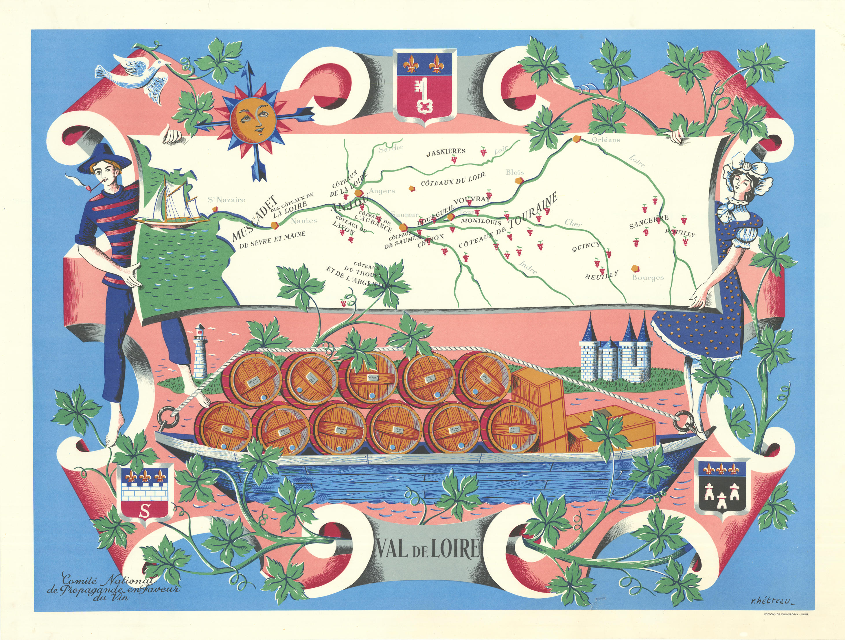
Caption below picture: [Les Vignobles de France - Vins du] Val de Loire
R�my H�treau (1913-2001) was French painter, graphic artist, printmaker, illustrator and designer. He was commissioned in the 1950s by the Comit� National de Propagande en Faveur du Vin, a French government agency tasked with promoting the nations wines and tourism to the wine growing regions, to create a series of illustrated maps entitled "Les Vignobles de France". There were supposedly eleven of these: R�gion Est, Normandie, Champagne, Bordeaux, Rh�ne, Bourgogne, Provence, Alsace, Loire, Roussillon & what was then the French colony of Algeria. However, Provence & Roussillon were combined into a single map, and we have never seen examples of the maps for R�gion Est or Normandie - neither of which regions are particularly noted for their wine. His highly decorative, exuberant maps display a joyful mid-century aesthetic; they have become much sought after. Art critic Ren� Barjavel said of him "In the world around him, it is always springtime. He has a blossoming tree in his heart"; a comment evident in these wonderful maps. The locations of the main white and red wine producing appellations are shown with grape bunch icons of the appropriate colour
DATE PRINTED: 1954
IMAGE SIZE: Approx 67.5 x 83.5cm, 26.5 x 32.75 inches (Large)
ARTIST/CARTOGRAPHER/ENGRAVER: R�my H�treau
PROVENANCE: Comit� National de Propagande en Faveur du Vin. �ditions de Champrosay, Paris
TYPE: Decorative vintage colour linen-backed wine poster map
VERSO: There is nothing printed on the reverse side, which is plain
CONDITION: Fair: The condition is very good. The map has been laid down on paper and backed with linen. This edition of the map, published with the �ditions de Champrosay imprint does not have the "Les Vignobles de France" scroll banner in the top margin present on the edition of the map which bears the Sopexa imprint. Please note any other blemishes on the scan prior to purchasing this picture. Please contact us if you would like to arrange to view this map. Virtually all antiquarian maps and prints are subject to some normal aging due to useand time which is not obtrusive unless otherwise stated. I offer a no questions asked return policy - see below.
AUTHENTICITY: This is an authentic historic print, published at the date stated above. I do not offer reproductions. It is not a modern copy. The term original when applied to a print means that it was printed at the first or original date of publication; it does not imply that the item is unique. Print means any image created by applying an inked block to paper or card under pressure by any method including wood engraving, steel engraving, copperplate, wood cut and lithography.
REMARKS: FRANCE: Gravures et Cartes anciennes. DEUTSCHLAND: Alte Lankarten und Stadt ansichten. ITALIA: Stampe e Mappe antiche. ESPA�A: Mapas antiquos y impresiones antiguas. E and OE. Force Majeure. English law shall apply.
RETURNS POLICY: I offer a no questions returns policy. All I ask is that you pay return shipping and mail back to me in original condition, suitably packed & insured, within 14 days of receipt.

